Artificial intelligence has revolutionized weather forecasting in just a few years, with global AI weather models now able to produce forecasts that rival some of the world’s best physics-based prediction systems.
This remarkable progress has been driven by three factors: massive amounts of weather data, advances in AI models and unprecedented computational power. While most of the current discussion on improving AI for weather focuses on the models or new hardware, the data is crucial.
At the global scale, AI has benefited from decades of climate and weather records covering the entire Earth. These datasets contain millions of examples of how atmospheric conditions evolve with time, allowing AI models to learn patterns in a way that would have been impossible a decade ago.
But when you zoom in from the global scale to the regional scale, forecasts start to be much more challenging for AI.
That difference matters for forecasting hurricane intensity.
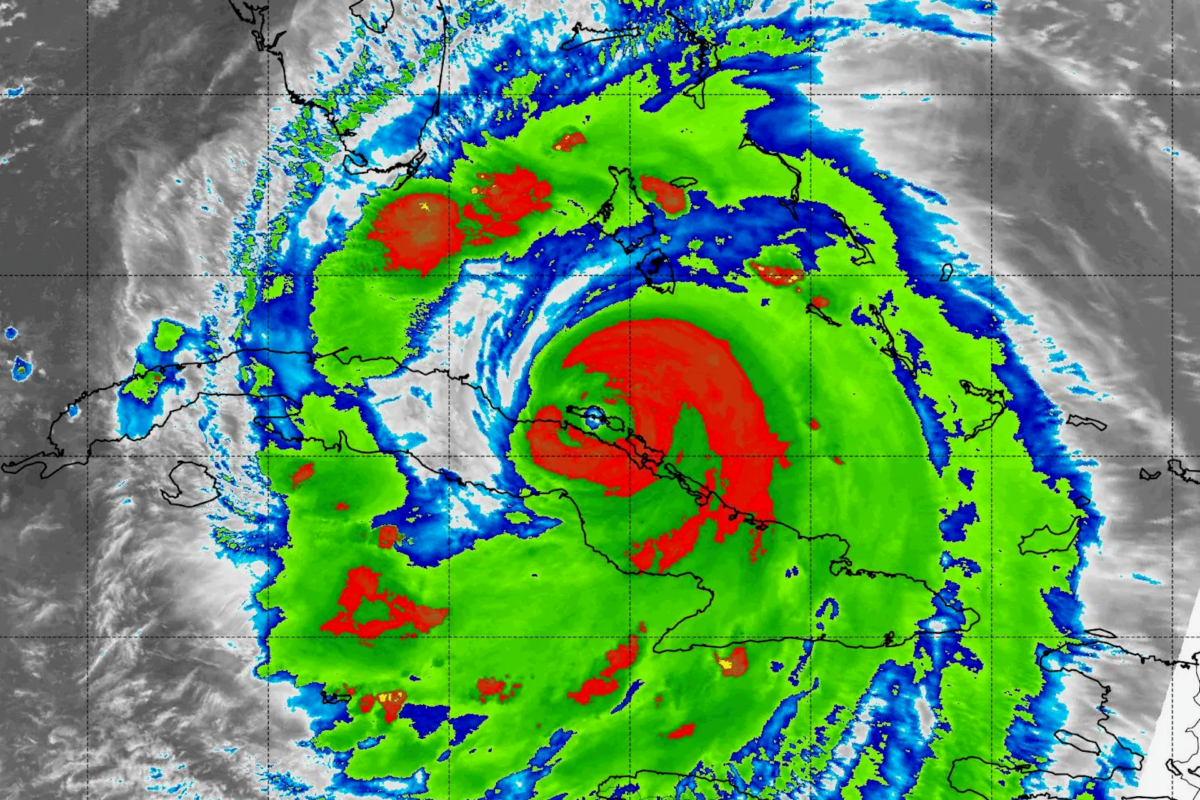
The world has seen many hurricanes rapidly intensify in recent years, strengthening from relatively weak storms into destructive monsters in a matter of hours. Hurricane Polo did it off Mexico’s Pacific coast as it rapidly strengthened from a tropical storm on Sept. 21, 2026, to a powerful Category 5 hurricane in 24 hours. Polo quickly became one of the strongest Pacific storms in decades, with winds reaching 180 mph.
When rapid intensification surprises forecasters – as Hurricane Michael did in 2018 when it grew into a destructive Category 5 hurricane right before hitting Tyndall Air Force Base and Mexico Beach, Florida, in 2018 – communities can be left with too little time to evacuate and prepare.
Why AI struggles with detail
Unlike global weather forecasts, hurricane intensity forecasts are often considered a regional forecasting problem. Regional forecasts are often concerned with extreme events, such as heavy rainfall, squall lines, severe thunderstorms or hurricanes.
These extreme events often develop rapidly or move quickly over short periods of time. Capturing such behavior in AI models requires data in much greater detail than current global datasets can typically provide.
When scientists train AI models to predict hurricane intensity, they usually rely on two sources of data.
The first is observations, which include measurements of rainfall, near-surface temperature, wind speed and other weather variables collected from weather stations, radars, buoys and satellites. Such direct observations can be detailed, but they are often limited to near-coastal regions and unevenly distributed, while many of the most important stages of hurricane development occur over the open ocean where direct observations are sparse.
Modern satellites can help fill some of these gaps in the open ocean, but they can help estimate only part of the rainfall, surface winds or cloud-top temperatures due to limits in satellite coverage. In particular, they cannot simultaneously scan a complete three-dimensional structure of every hurricane around the globe. At present, even the best observational systems provide only a partial view of hurricanes at any point in time.

NASA’s Scientific Visualization Studio
The second source of training data comes from weather model simulations, which combine atmospheric conditions and knowledge of physics to provide the most complete three-dimensional picture of the atmosphere at high resolution.
However, this simulated data is not perfect either, because all computer models contain approximations and uncertainties arising from incomplete knowledge of the Earth’s atmosphere. As such, there are always fine-scale processes that model simulations cannot capture.
So, we simply don’t have a good full, three-dimensional dataset to train an AI model for hurricane intensity prediction at present.
The other challenge: Chaos
But data is not the only issue for AI hurricane prediction.
Suppose in the future scientists could measure the entirety of a storm, measured every second, for thousands of storms around the world. That still might not allow AI to predict hurricane intensity perfectly. The reason: chaos. Tiny differences in the initial state of a hurricane can quickly grow over time.
My recent research with colleagues suggests that hurricanes may contain some element of chaos that can prevent AI models from accurately predicting hurricane intensity at long forecast times.
Once embedded in a favorable environment, a tropical storm can intensify toward a maximum possible strength. Scientists call this upper limit the potential intensity. It is determined primarily by the surrounding environment. For example, warm ocean water can fuel a hurricane’s intensity, or wind shear can slow down a hurricane’s development. If the ocean temperature rises, the potential intensity of a hurricane increases, too.
Any small disturbances will also cause the hurricane intensity to fluctuate. The warmer the ocean surface, the more fluctuations.

Chanh Kieu
Recent studies have proposed that these fluctuations are not purely random but occur within what is known as a chaotic attractor – a set of possible storm states within which the hurricane can evolve unpredictably. Although the existence of such a chaotic intensity attractor has not yet been fully established, it presents a fundamental dilemma for training AI models to predict hurricane intensity.
On one hand, scientists want AI models to make the most accurate predictions possible. Thus, during training the goal is to minimize the difference between the forecast and what actually happens until an AI model achieves the smallest possible error.
On the other hand, we also want the AI model to capture the hurricane’s intrinsic chaos. But if an AI model can capture this chaos, then its error cannot be reduced indefinitely. So, an AI model trained to minimize forecast error may learn the most likely evolution of a hurricane while smoothing out unpredictable fluctuations. In this regard, these two goals compete with one another.
With data always containing some uncertainty, the rules an AI model learns are only approximated. The accuracy of hurricane intensity forecast will therefore get worse after just a few days.
What will it take to make better forecasts?
The challenge for AI models to predict hurricane intensity is not just about obtaining more data, building better neural networks or deploying faster computers. It is also about understanding hurricane behaviors and how chaos in intensity emerges.
Both dictate whether AI models can learn what is predictable and what is unpredictable. That distinction not only puts a cap on our current hurricane intensity forecast accuracy but also determines the next generation of weather forecasting and evaluation systems, which should focus on a range of possible hurricane intensities and their probabilities instead of a single intensity number.

Chanh Kieu receives funding from the US National Science Foundation